The Site: Excavations and Finds
The exhibition set out what was known about the site in 1998. Since then, archaeological work has continued: for an up-to-date illustrated survey, see https://www.oxirrinc.com/en/.
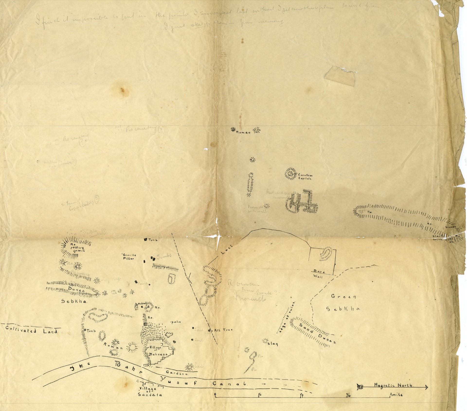
Draft Plan of Oxyrhynchus, c. 1900
This drawing presumably served as the draft from which the revised map was prepared. It carries many details omitted from the revised map, and has proved vital in understanding aspects of the latter and of the Flinders Petrie plans.
The map is displayed with west at the top. Distance from left to right of the map is around two miles; the enormous zone which was to prove most fruitful in the search for papyri is marked ‘Roman mounds’, NW of the modern village and roughly in the centre of the frame. There were no houses here; this was the main ancient rubbish dump. The ancient town buildings, of which little is left and even less visible, lay closer to the modern village, roughly in a half-mile-radius semi-circle around it; see the modified map. Note the D-shaped mound not quite half a mile west of the modern village: this appears as a temple on the revised plan, but was part excavated by Petrie and found to be a huge theatre.
Just over half a mile north of the modern village, ‘slag’ is marked on this map; this area was investigated in excavations in the 1980s and proved to be an industrial zone with large numbers of pottery kilns.
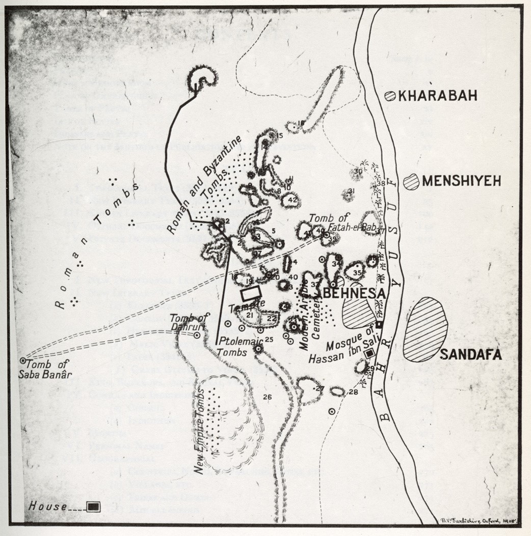
Revised Plan of Oxyrhynchus, 1908
This plan was presumably prepared from the rough pencil version. Grenfell and Hunt intended to publish it but never did; it was eventually published in the fiftieth volume of The Oxyrhynchus Papyri in 1983.
Information absent from the draft map is the numbering system for the rubbish mounds; this was not understood when the plan was published in 1983, but the discovery since of a small black notebook provides the key.
The rectangular building labelled ‘Temple’, not quite half a mile west of Behnesa (for the scale cf. the earlier plan) is Petrie’s huge theatre.
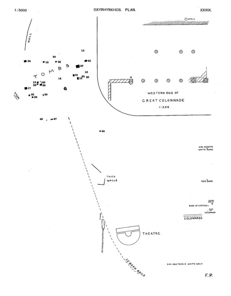
Plans of Parts of the Site, 1922
Sir Flinders Petrie excavated various parts of the site in 1922 and drew up plans. They show a colonnade, the city’s large theatre and a column he identified as ‘base of statue’.
Reproduced from F. Petrie, Tombs of the Courtiers and Oxyrhynkhos (1925), pl. XXXIX.
A fine vaulted chamber of a tomb of the Saite period (c. 5th century BC) was located by the Catalan archaeological mission in 1992, on the edge of the rubbish-mound zone which produced the bulk of the papyri recovered by Grenfell and Hunt. For images and further information, see https://www.oxirrinc.com/en/el-yacimiento/necropolis/.
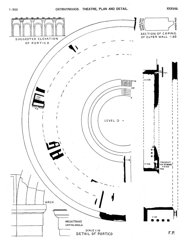
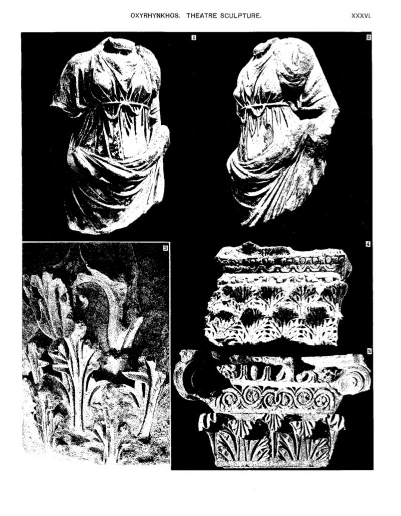
The theatre was partially cleared by Petrie in 1922. It was roughly 400 feet in diameter, and Petrie estimated its seating capacity as over 11,000, which has been used as a factor in estimating the city population, possibly around 30,000 people. Numerous fragments of sculpture and carvings were found among the theatre ruins. A curious feature of the theatre was a spiral staircase of mediaeval castle type at each end of the stage, a feature unparalleled in any other ancient theatre.
For a virtual reconstruction of the theatre, see https://www.oxirrinc.com/en/difusion/multimedia-3d/teatro-3d/.
F. Petrie, Tombs of the Courtiers and Oxyrhynkhos (1925), pl. XXXVI, XXXVIII.
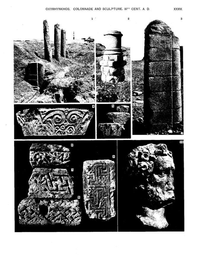
Petrie located and partly cleared a long double colonnade. The columns are single blocks of limestone and once had crude Corinthian capitals. They measure something under a metre in diameter, and the tallest still measured nearly six metres high. The overall length of the colonnade was around eighty metres.
The function of this colonnade remains uncertain. Petrie thought in terms of a colonnaded street, a poor relation of the grand avenue at Palmyra. Against this are the low base running across the colonnade, seen on Petrie’s plan, and the attached half-column at the western end, seen in the photograph; such half-columns are expected on the ‘show’ façade of a structure, not tucked away at the back. In association with the building-repairs accounts no. 4441 in vol. LXIV of The Oxyrhynchus Papyri, we wonder whether the colonnade might represent the Northern Stoa, that is one of four covered colonnades that enclosed a large square like a cloister, but that interpretation too has its difficulties.
F. Petrie, Tombs of the Courtiers and Oxyrhynkhos (1925), pl. XXXV.
Denon, 1798
Baron Vivant Denon made a drawing of a column on the same occasion as his long-distance drawing (this column may be discerned on its right-hand side). Grenfell and Hunt make no mention of this column, nor do they show it on their plans; it must have vanished by the time of their first visit in 1897. Features in the background, still visible today, enable its position to be located.
What we see in Denon’s view is only the upper part of the column. The lower part was presumably buried in sand; at any rate, it must have been buried in 1897–1907 because Grenfell and Hunt do not mention it either, but it was partially visible by the time of Petrie’s visit in 1922.
Petrie, 1922
By this date the section of the column drawn by Denon had vanished; clearance of sebakh (the ancient site soil, prized as fertilizer: see Petrie’s letter) was slowly revealing the column’s lower courses.
The column has been named the ‘Phocas pillar’ because it bears at the top a roughly cut inscription in honour of the late Roman emperor Phocas, on the part of the Blues circus faction. The column itself is much older than this, perhaps dating from the second century AD.
c. 1950
Almost clear: a 1950s view in the Project’s keeping shows the column still surrounded by millions of fragments of broken pottery as if by a pebble beach. The present ground level is still a metre or so deeper down at this date. A lot more of the ruined mosque on the right was to collapse by 1981.
1981
A more-or-less contemporary view of the column was taken by Revel Coles and is kept with the Project’s holdings. The eroded remains of the honorific inscription for the emperor Phocas may just be discerned near the top. This exhibit includes a view of Bahnasa from the north-west which shows the remains of the column today (see below).
Reconstructions
D. M. Bailey has produced a reconstruction of parallel honorific columns in Egypt, showing how the two parts of the ‘Phocas pillar’ might have looked when complete with the (probably) imperial statue which would have crowned it. It would have been roughly the same size as his Antinoe example (a site in Middle Egypt). See D. M. Bailey, Excavations at El-Ashmunein IV (1991), pl. 39.
It is possible that the complete column was only one of four, the other three having vanished completely, which formed a tetrastylon; that is to say, the four columns stood grouped in a square at the crossing of two major streets of the city. The crossing streets might pass or actually cross through the middle of the four grouped columns.
For a virtual reconstruction of the column, see https://www.oxirrinc.com/en/difusion/multimedia-3d/columna-honorifica-a-focas/.
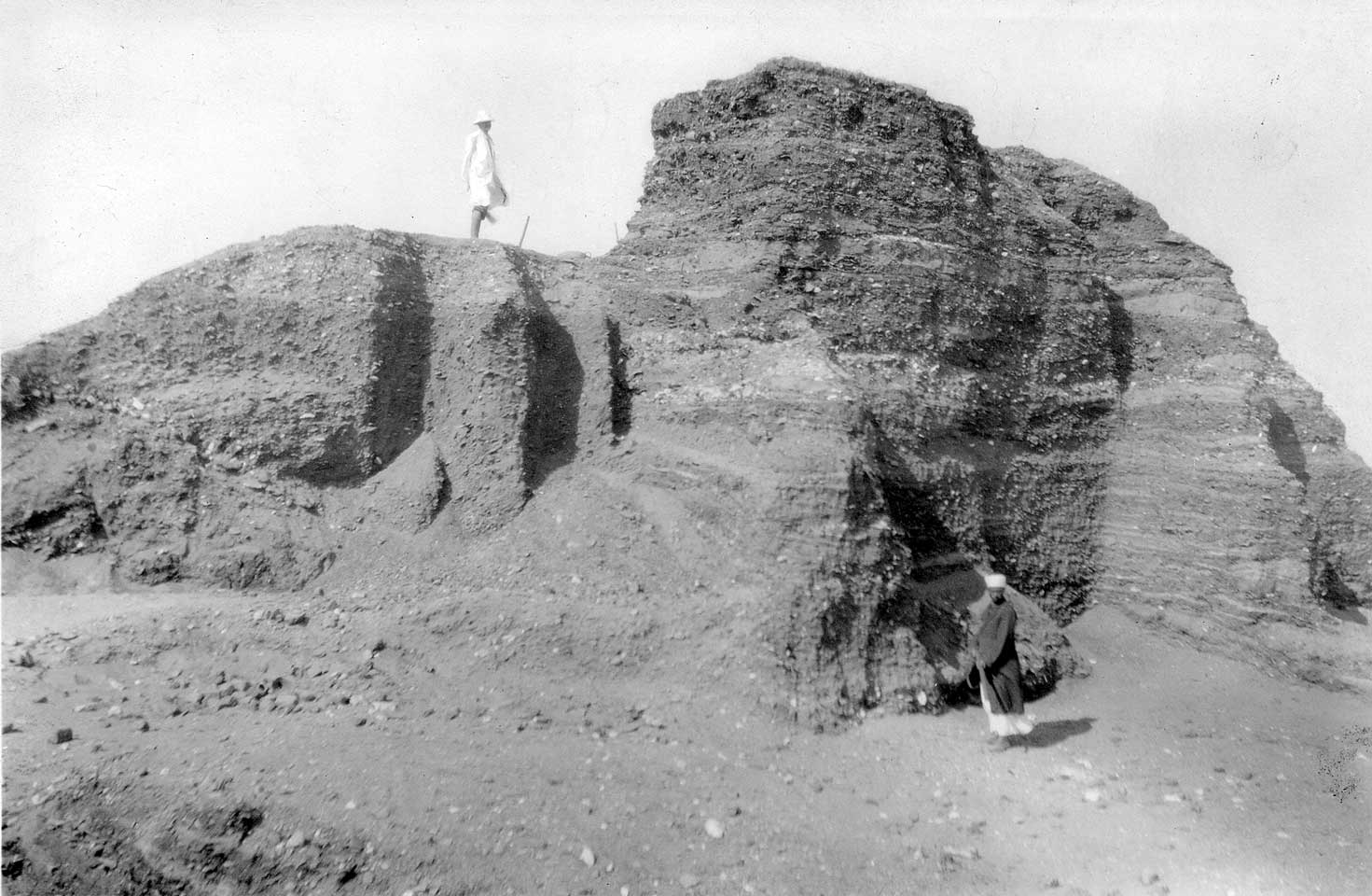
Not far to the north-east of the theatre was a large rubbish mound crowned by the venerated tomb of a mediaeval Sheikh, Ali Gamman, and often referred to as Kôm Gamman (Kôm = mound). To judge from what was found in the mound, this spot was used as a rubbish dump for 600 years at least, starting in the first century AD; such use may surprise us, in a spot in the midst of monumental structures (theatre and colonnade) and almost on the line of a conjectured ancient main street.
This mound was numbered K 20 on Grenfell and Hunt’s plan, and identified as Kôm Gamman in the black notebook. It was a particularly rich source of rare literary manuscripts, but the presence of Ali Gamman’s tomb on its top prevented Grenfell and Hunt from investigating it thoroughly. In the 1930s an Italian team obtained permission to dismantle the tomb and re-erect it elsewhere; a consequence is the number of literary papyri in the Oxyrhynchus collection of which further portions are now in Florence.
Ancient and mediaeval tombs dot the rubbish-mounds west of the modern village and the ground beyond towards the desert. Now as then, the site serves as the principal cemetery not only for the modern village but for a considerable area round about. The modern cemetery is located close in to the village, west and south-west of it, partly on flat ground but partly with tombs scattered over the tops of nearby rubbish mounds, preventing excavation there. These mounds apparently contained only mediaeval and later rubbish, not papyri, and were ignored by Grenfell and Hunt, but they may well conceal architectural remains of the Roman period, for example the conjectured north-south extension of Petrie’s colonnade. More such architectural remains may well lie directly under the modern village.
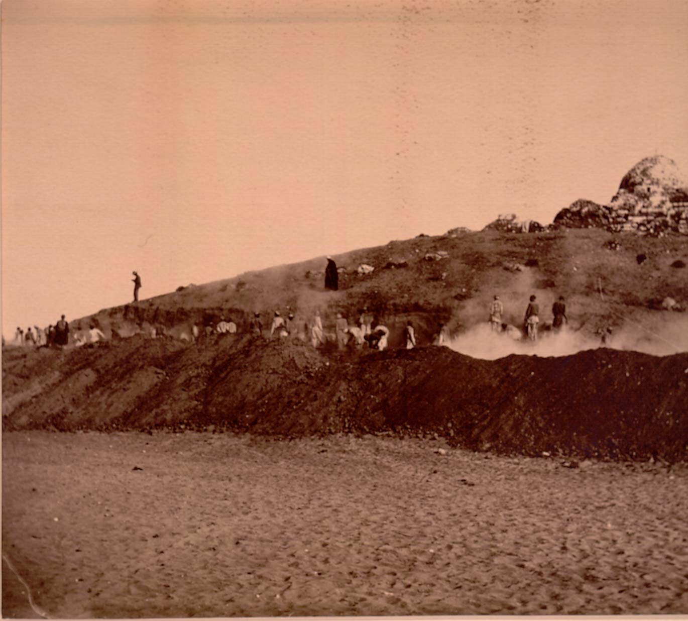
These photographs were taken by A. S. Hunt probably during the second season of excavations.
The start of work around the rubbish mound crowned by the tomb of the sheikh Abu Teir (mound no. 23 on the site plans?). Grenfell stands against the skyline.
A close-up of the work in progress, showing the appallingly dusty conditions. In the foreground the diggers loosen the undisturbed soil with picks, while those in the background carry the sifted soil away in baskets to be dumped clear of the work area. The team comprised around 200 workmen.
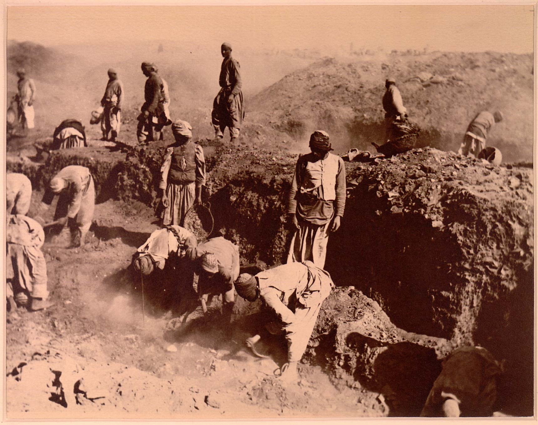
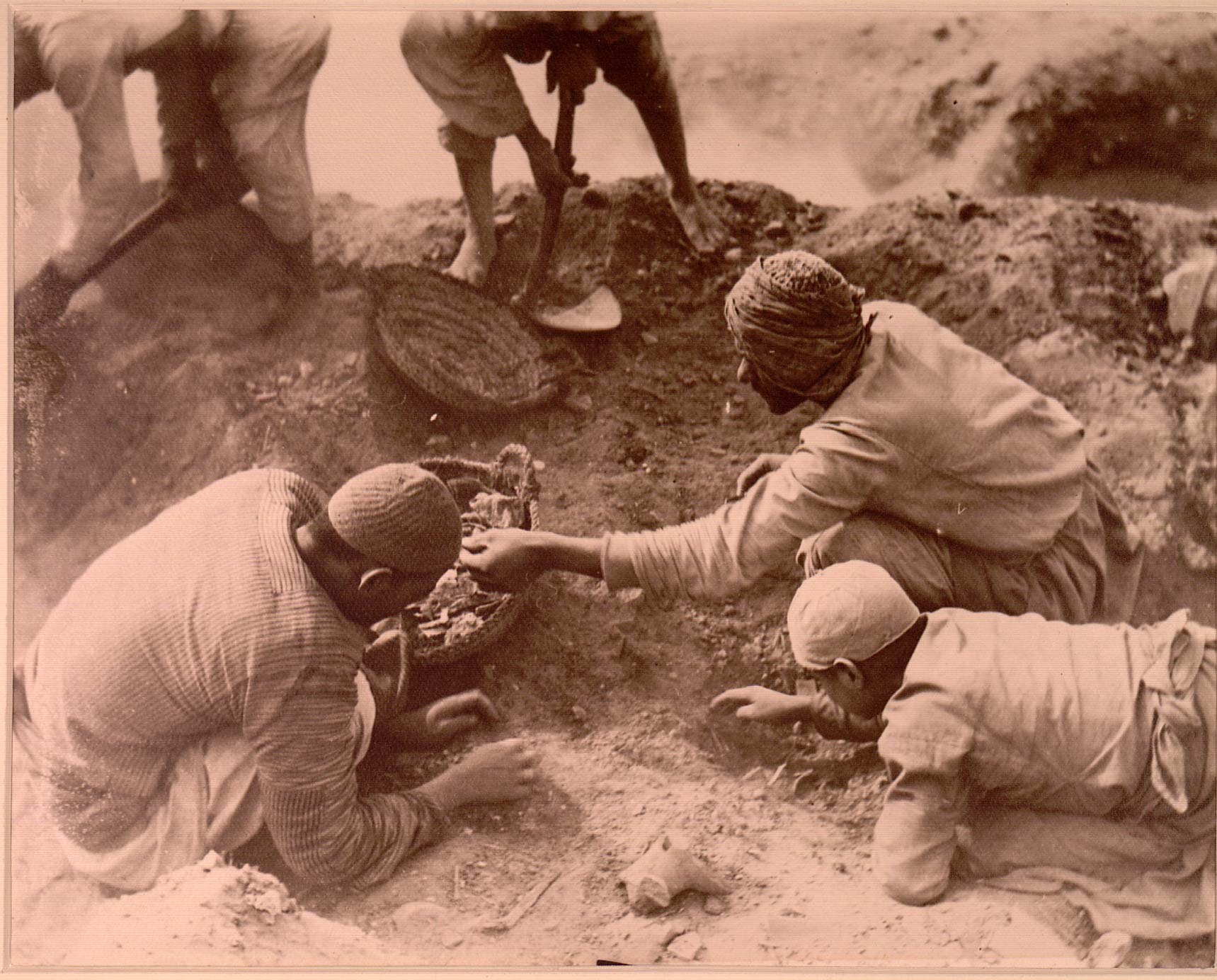
Workmen carefully extract the papyrus fragments from the dust, collecting them in more baskets. Some days, more than thirty might be filled with papyri, for Grenfell and Hunt to sort overnight so as to release the baskets for the next day’s work.
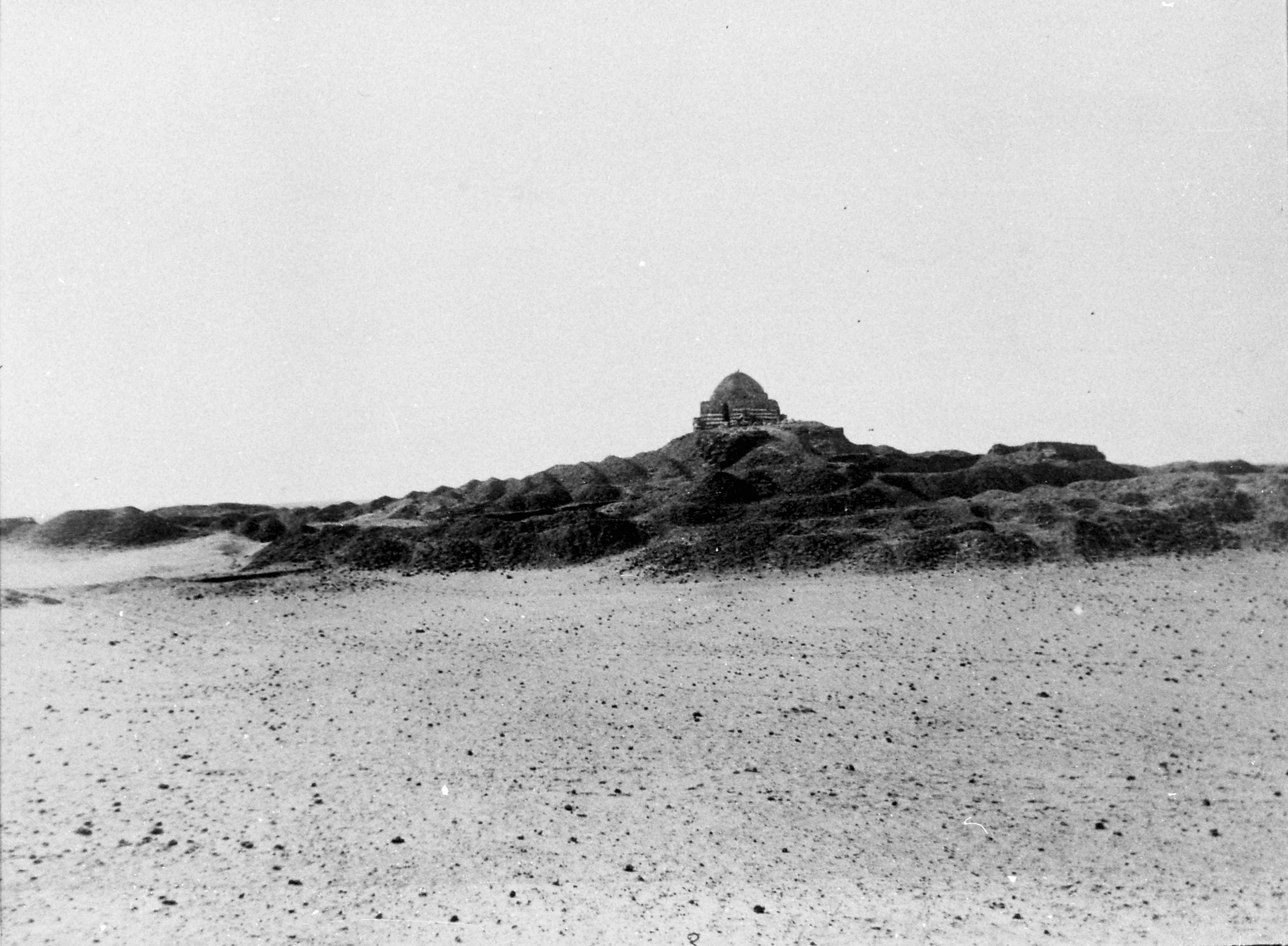
The mound of Abu Teir when the excavators had dug as close to the sheikh’s tomb as they could; the view shows how the sifted soil was not removed but just piled up in a different place. That so much of it is no longer there is due to its later extraction for use as fertilizer.
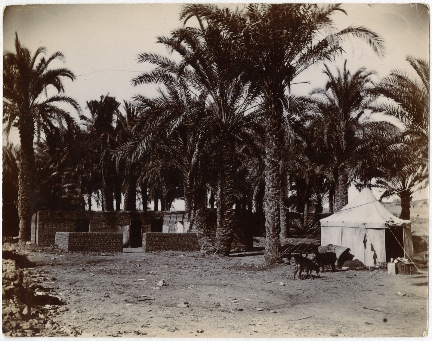
The excavators were provided with the relative comfort of a mud-brick house as their base during the excavations; this is where the nightly work of sorting and packing the day’s finds would have gone on, to release the baskets for the workmen to use the next day. No doubt they also spent time here in preliminary decipherment of some of the papyri, all by the light of paraffin lamps.
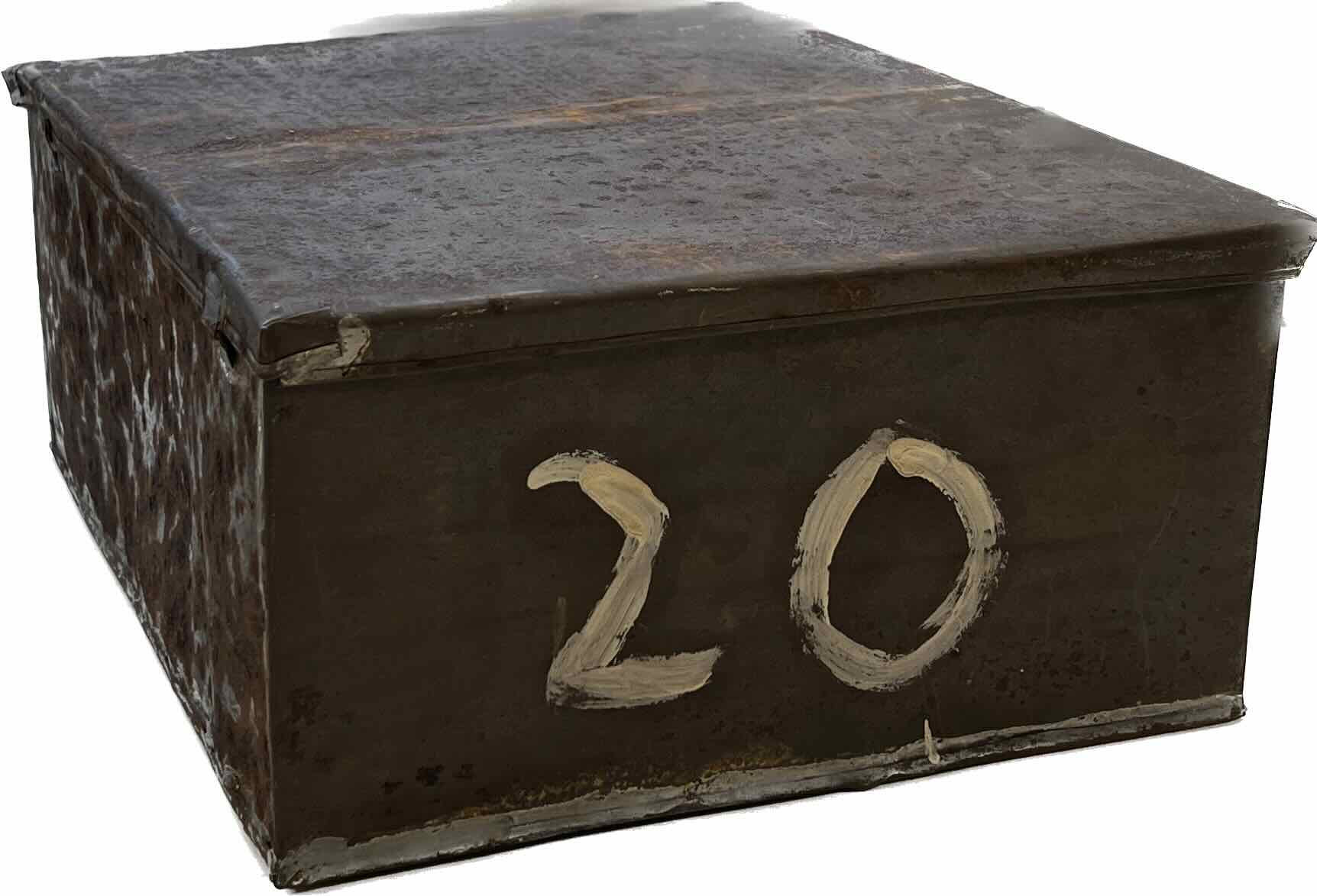
Metal tins were made up on site for packing up the papyri as they were found. Grenfell and Hunt gave the tins consecutive numbers in a simple sequence which alas does not enable the tins to be linked to specific rubbish-mounds.
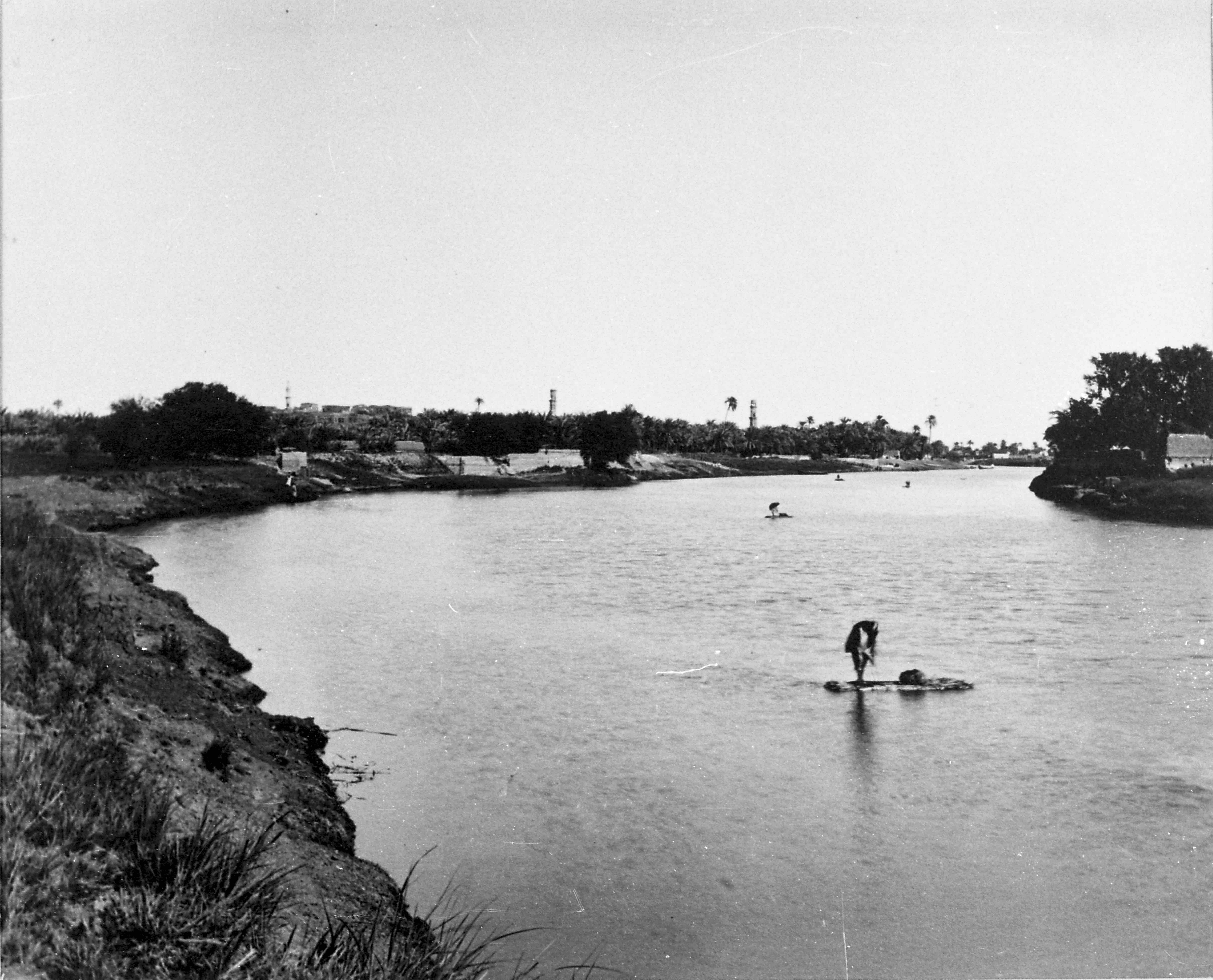
The modern village of el-Bahnasa (ancient Oxyrhynchus) is stretched along the west bank of the Bahr Yussuf, ‘Joseph’s Canal’, actually not a canal but a natural branch of the Nile. It is now linked by a bridge to the modern village of Sandafa (ancient Sintabo?), once subordinate to but now much larger than Bahnasa. There was no bridge here in ancient times, crossing the ‘canal’ being by ferryboat only.
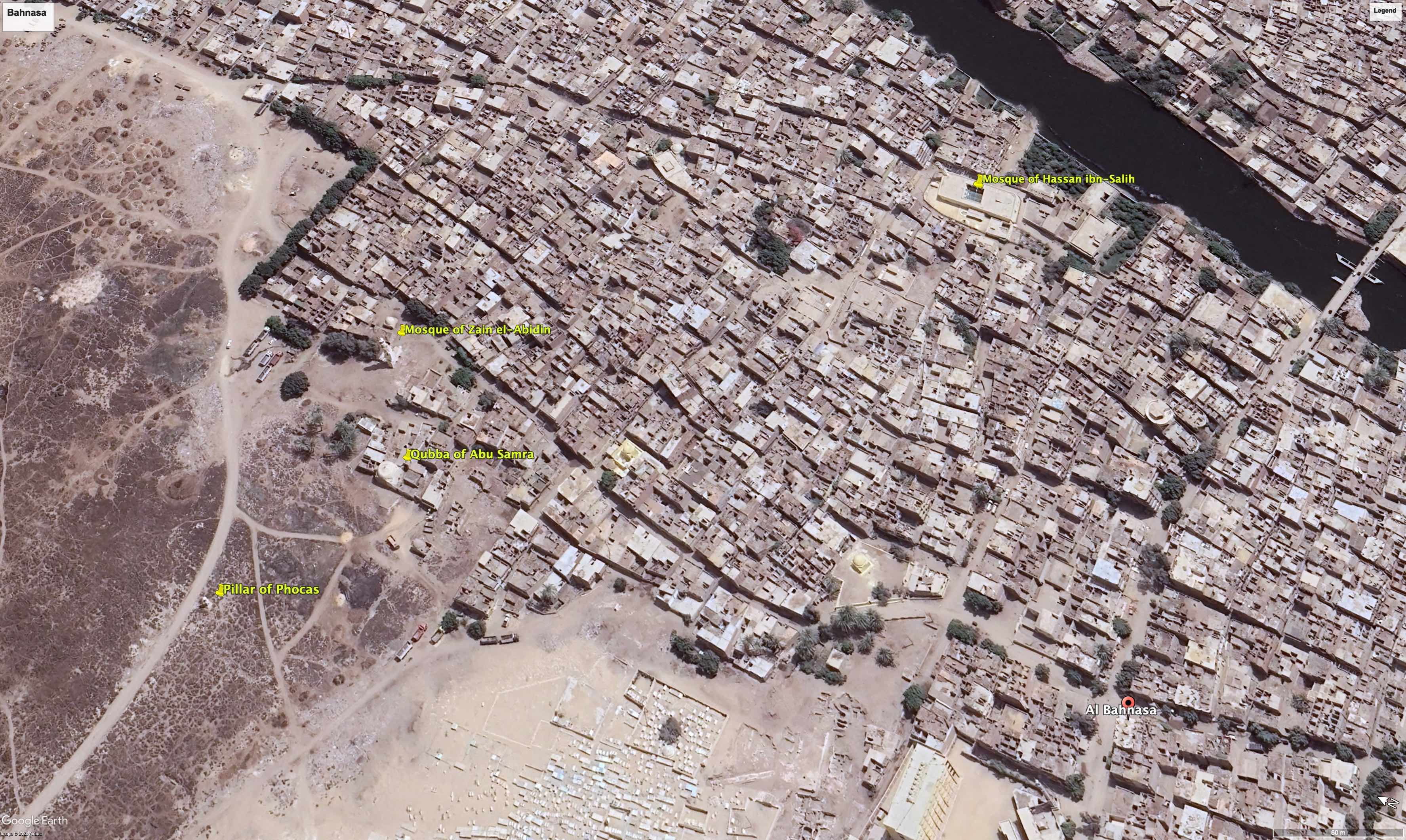
Photographs were taken during the Kuwait-financed work at the site in the late 1980s under the direction of Professor Géza Fehérvári, by attaching a camera to a kite by up to 200 metres of line. A higher altitude view shows the northern end of the modern village, looking north-east. An equivalent satellite image from Google Earth is reproduced below. The Bahr Yussuf is at the upper right corner, with the late 9th century mosque of Hassan ibn-Salih on the nearer bank; this was the first mosque to be built in Oxyrhynchus/Bahnasa, on the site of the principal Christian church of the Byzantine town. It is said that the pillars of that church are still visible inside the mosque.
The ruined 15th-century mosque of Zain el-Abidin is in view at the left of the picture. Rescue work on this building was one of the main aims of the Kuwaiti mission. The dome near it is the qubba of Abu Samra (18th century), prominent in other views of this area; the ‘Phocas pillar’ is further out to the left.
After a long interval, archaeological work was renewed by the Egyptian Antiquities Service periodically from 1982, and then by a Kuwaiti-financed mission from 1985 to 1987. The Kuwaiti team had a number of objectives, one being concerned with the ruined 15th century mosque of Zain al-Abidin at the north-western edge of the Islamic village. They also made exploratory trenches at a number of other locations near this part of the site. Trench E, under the yellowish walls of the 18th century qubba of Abu Samra, exposed an extensive complex of walls and rooms of various dates, including the handsome paved street shown in photograph in the exhibition, perhaps of the early 10th century AD. In one of the rooms in this area, buried in a leather bag inside an earthenware pot, a hoard of 200 gold dinars was found, dating from the late 10th–early 11th century AD.
See now G. Fehérvári et al., The Kuwait Excavations at Bahnasa/Oxyrhynchus (1985–1987): Final Report (Kuwait 2006), and G. Fehérvári, 'The Kuwaiti excavations, 1985–7', in A. K. Bowman et al. (edd.), Oxyrhynchus: A City and its Texts (London 2007) 109–28.
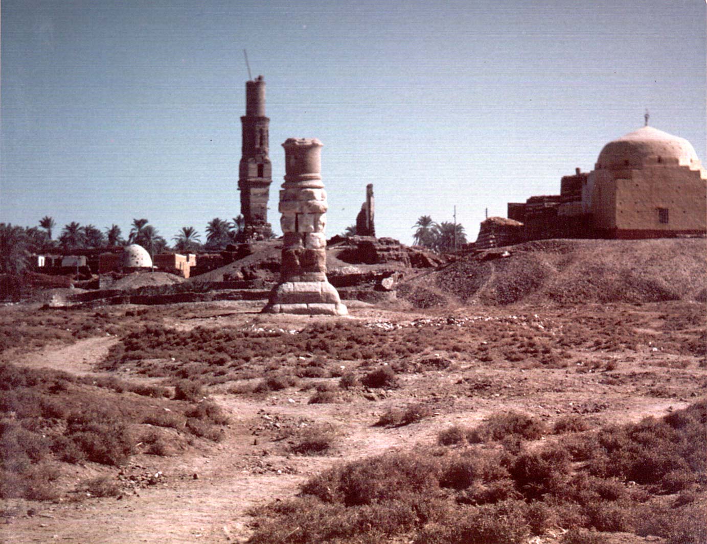
This view links the three distinctive features of this area of the site: the dilapidated 15th century mosque of Zain el-Abidin in the background on the left, the prominent yellow dome of the 18th century qubba of Abu Samra on the right, and the stump of the Roman honorific column (the ‘Phocas pillar’) in the foreground. The collocation of these three elements helped to locate the viewpoint in the Denon drawing of 1798, showing the upper part of the column.
In the 1980s the Kuwaiti team working at the site surveyed the area marked ‘slag’ on Grenfell and Hunt’s early plan, a kilometre north of the modern village, and located some 40 kilns used for the production of pottery. These kilns appear to be of late Roman date (fifth or sixth century AD). The one shown in the Ashmolean display preserves its floor supports, consisting of deliberately-cut amphora necks.
See A. Challands in G. Fehérvári et al., The Kuwait Excavations at Bahnasa/Oxyrhynchus (1985–1987): Final Report (Kuwait 2006) 56–60.
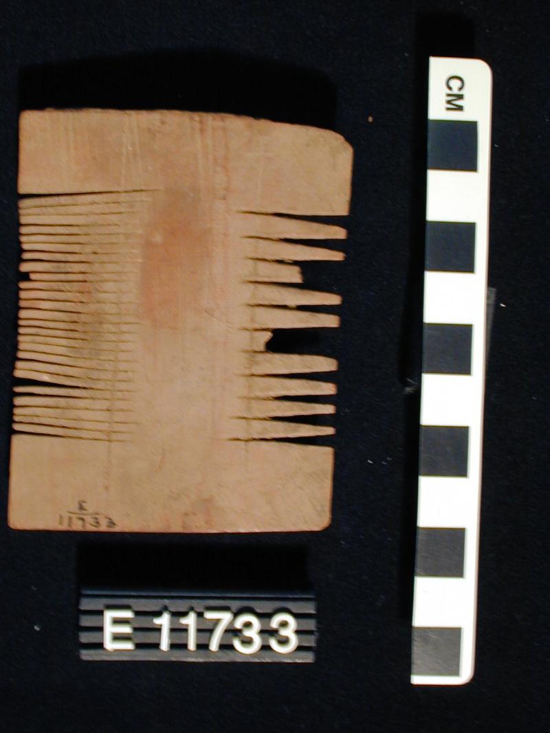
Double-sided wooden comb with fine and wide teeth on each side. An object of everyday personal use, it is representative of thousands of such remnants of material culture which filled the rubbish mounds of Oxyrhynchus, side by side with the papyri. For other objects found by Grenfell and Hunt in Oxyrhynchus, see e.g. https://www.penn.museum/collections/accessionlot.php?irn=5324.
Penn Museum E11733.
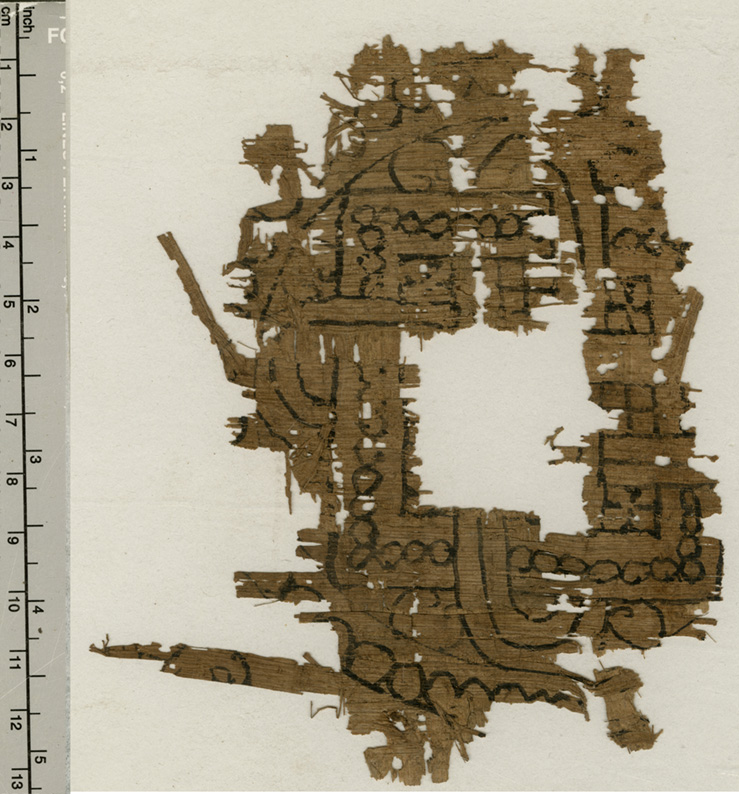
Complex interlace patterns woven in two colours were frequently used in the form of bands, roundels or squares for the decoration of tunics and other textiles from at least the later 3rd century on. A pattern on papyrus like the one below from Oxyrhynchus may have been fixed under the warp threads when the textile was being produced. The fragmentary design here for a roundel with interlocked square and cable may be compared to two examples in the Ashmolean Museum’s collection.
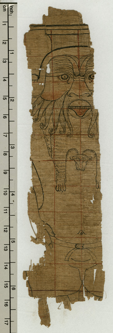
The god Bes, dwarfish of form and leonine of face, remained a popular divinity in Egypt well into the Roman period; his function as a protector of children and of mothers giving birth was doubtless influential in this, as well as his happy association with music and dancing. His protective figure was to be found in the 'birth houses' of Graeco-Egyptian temples, and he seems to have found his way into other sanctuaries, too: P.Oxy. XLIX 3473, an inventory of AD 161–9 listing items in a temple of Apollo, cites 'a bronze Bes' in the propylaeum.
The figure is drawn here in the traditional Egyptian manner in which preparatory drafts were made for both two- and three-dimensional representations, with a grid drawn in red, on which the figure or scene was superimposed in black. Amongst other functions, the grid helped to maintain the canonical system of proportions to which figures conformed in Egyptian art: in the version of this used during the Graeco-Roman period, a normal figure would occupy 21 squares, measured from the upper line of the eyes to the soles of the feet; if completed, the little person of Bes shown here would probably occupy 12 squares.
The drawing seems to have been made for the creation of sculpture, but whether relief or in the round is not clear.


